
")
")
")
Carlson Civil Suite - Advanced Civil Design Software
Carlson Civil Suite 2026 – Comprehensive Civil Engineering & Land Development Tools
Carlson Civil Suite is a powerful, all-in-one software package designed for civil engineers, land surveyors, and site design professionals who demand precision, efficiency, and reliability. Combining four industry-leading modules — Carlson Civil, Carlson Survey, Carlson Hydrology, and Carlson GIS — this suite provides everything you need to take projects from concept to completion
Whether you’re working on road design, subdivision layouts, stormwater management, hydrology modeling, or GIS mapping, Carlson Civil Suite equips you with advanced tools to streamline workflows and reduce costly project overruns. With seamless integration into AutoCAD® and IntelliCAD®, it ensures compatibility with the platforms professionals already use daily
Carlson Software’s Civil Suite is a powerful software bundle made up of: Carlson Survey, Carlson Civil, Carlson Hydrology, and Carlson GIS. These four civil-related modular programs, working together, will allow you to create all of your deliverables at a fraction of the long-term costs compared to other software alternatives.
Carlson Software’s Civil Suite is a powerful software bundle that includes:
These four modular programs allow you to create all deliverables at a fraction of the cost compared to other civil software alternatives. The Carlson Civil Suite is designed to streamline your workflow and increase productivity with intuitive tools and automated processes.
Civil Design
 Road and Site Design Made Easy
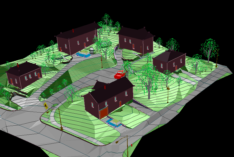
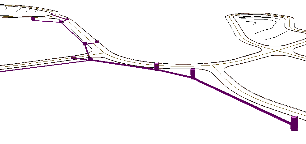
Carlson Civil provides the most robust automation and ease-of-use of any civil design solution available today, and it does dynamic updating without a single custom object. Carlson Civil’s wide selection of “power” tools enable users to increase their productivity as they create better road, site, and subdivision designs in less time.
Hydrology
 Complete Hydrologic and Hydraulic Solution
Carlson Hydrology is a comprehensive, yet easy-to-master hydrologic and hydraulic software solution that works simply in the commonly used CAD environment of polylines, text and layers. Carlson Hydrology provides site drainage and runoff analysis, plus storm drain system design and drafting, and pond design and sizing.
GIS
 Put Your Designs on the Map
Providing tools for data capture and linking, data labeling, import/export of SHP files, polygon topology creation and analysis, and more, Carlson GIS is an awesome GIS “Swiss Army Knife” for the surveyor or engineer.
Survey
 Work Seamlessly Between the Office and Field
A productive and intuitive survey solution complete with SurvNET Network Least Squares and drivers to connect to essentially every manufacturers’ proprietary hardware and software, Carlson Survey is the #1 office software solution for surveyors in the United States and is gaining in popularity around the world.
Learn more about Carlson Survey here.
Key Features
With Carlson Civil Suite, tasks that might take days with other civil software can be completed in hours or even minutes. It supports both AutoCAD (versions 2010 to current) and the built-in IntelliCAD 10.1. Key features include:
Road NETwork
Design roads, intersections, and cul-de-sacs in both 2D and 3D with a single click of the PROCESS button.
SiteNET
Enhance estimating accuracy with this layer-based surface generator and earthwork calculator.
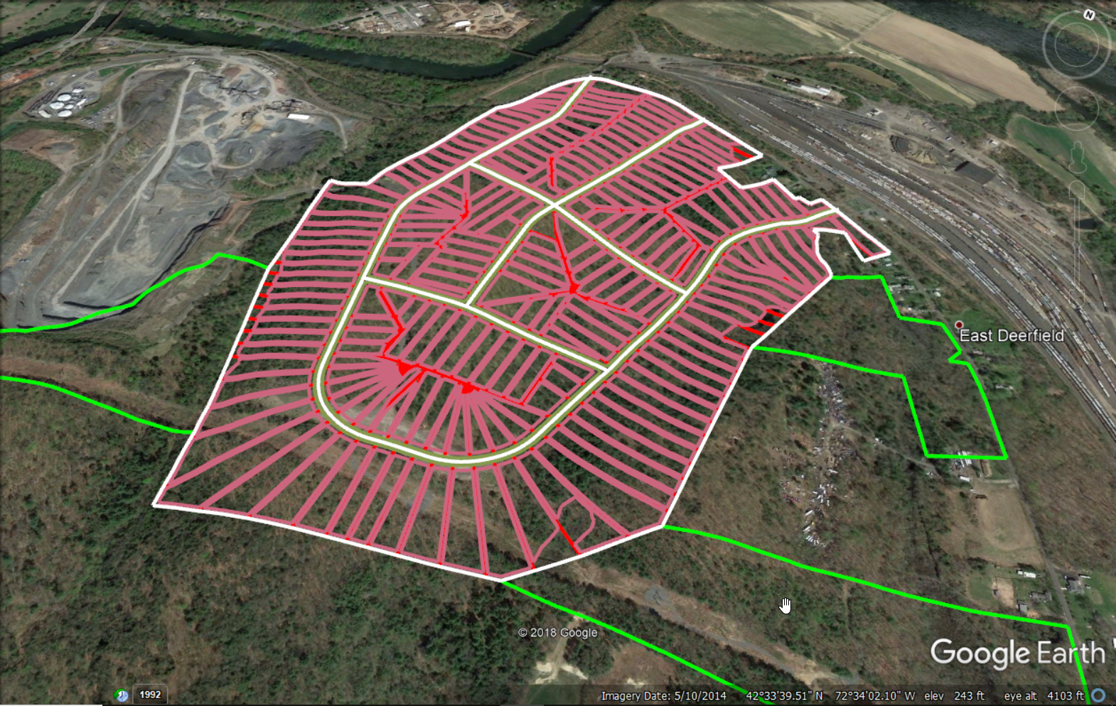
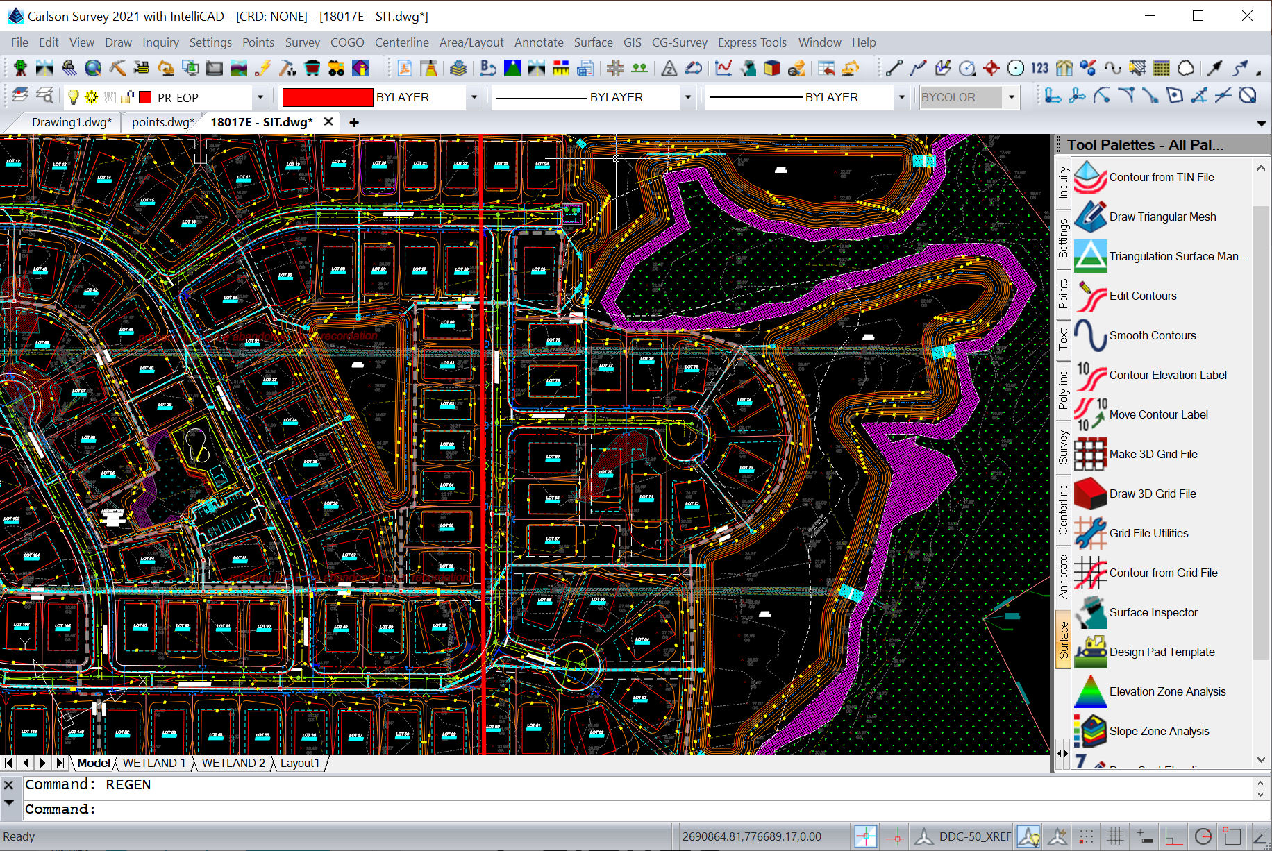
LotNET
Quickly define entire subdivisions based on outer boundaries, interior ROWs or centerlines, and user-defined rules. Simply pick PROCESS and the lots appear, fully defined and labeled.
Drawing Cleanup
Perform data integrity checks, convert proprietary objects into usable entities, and eliminate redundancies to gain complete control over the drawing, no matter the previous modifications.
Join Nearest
Enhanced command that allows you to set tolerances and safety checks when joining objects together.
Shrink-Wrap Entities
A time-saving method for defining boundaries.
Drawing Inspector
Provides instantaneous and dynamic readouts of bearings, distances, elevations, and other QA data.
3D Viewer Window
View perspectives and elevation analyses of 3D data and surfaces, eliminating the need for costly graphics hardware upgrades.
2D & 3D Polyline Utilities
Enhance the use of polylines with tools that AutoCAD® does not provide.
Erase by Layer
Efficiently remove data on specified layers without isolating, erasing, and restoring them.
Quick Keys Editor
Quickly create shortcut commands to streamline your projects.
Point Data Management
Organize point data with tools for setting, managing, modifying, and reporting.
Product Data Management
Define and assign project folder structures tailored to your organization’s needs, with options for varying levels of complexity.
Surface Modeling
Develop and analyze surfaces, contours, and labels in a single step. Ensure data integrity with automatic labeling and sharable files.
Annotation
Produce well-documented project plans efficiently with tools from Carlson Civil’s annotation library. Includes options to personalize and clean up complex annotations, with automatic text overlap checks.
Volumes
Perform accurate volume computations using industry-standard algorithms. Generate detailed reports, cut/fill labels, color maps, and centroids within the drawing file using intuitive tools.


 2026")